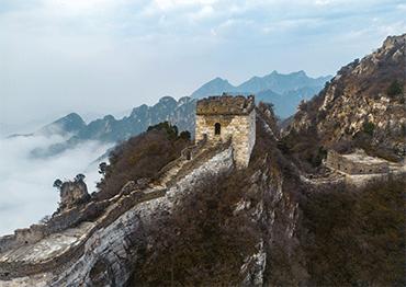
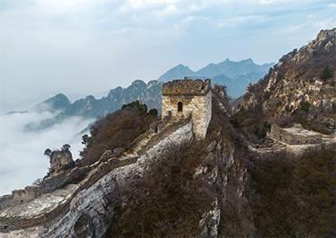
utumn is the best time of year to view the Great Wall. Nestled in a stunning display of colorful leaves, the Wall is an enduring symbol of China’s culture that continues to captivate the imaginations of visitors from around the world.
Spanning more than 20,000 kilometers and constructed over 2,000 years, it served as a military defense for an agricultural civilization against nomadic invaders, and now stands as a world cultural heritage site.
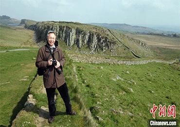
For Li Xiaocong, a historical geography specialist and emeritus professor at Peking University, ancient maps of the Wall are invaluable artifacts. His research, which has taken him to libraries across the globe, focuses on decoding what these maps say about the Wall’s significance to ancient people both from China and other countries.
CNS: How did you go about searching for ancient maps depicting the Great Wall?
LX: My fascination with the Great Wall began in childhood. I first visited the Badaling section in Beijing as a middle schooler, cycling for hours with friends to reach it. Sixty years have passed since then. I’m 77 years old now, and the Wall is still integral to my life and work.
I started researching the Great Wall on ancient maps more than 30 years ago, when I first traveled abroad in 1991 to study ancient Chinese-language maps collected in Europe. I came across two articles about the Great Wall in the Netherlands. One is a travelogue about the Vatican, which mentions a painted map of the Great Wall in the collection of Rome’s Basilica of St. John Lateran. This map was also mentioned in an article by British scholar M.J. Meijer, which included a black-and-white picture of it.
I decided to follow these clues. In 1992, I traveled to Rome in search of the map of the Great Wall mentioned in the articles, but was told that the Basilica’s collection of documents and archives had been moved to the Vatican Apostolic Library in the 1960s. So I headed over there, where staff told me the map was not cataloged, making it unclear whether the map was actually in the collection. I left the Vatican disappointed, but I believed the map was still there.
During that trip, I also paid a visit to the renowned Italian Sinologist Giuliano Bertuccioli. He told me that the Italian Geographical Society had the ancient Chinese map I was looking for in its collection. With his help, I was able to check the Italian Geographical Society’s catalog. Instead of finding that map, I found two other Great Wall-related atlases about the Datong Garrison [in today’s Shanxi Province] and the Gansu Garrison [in Gansu Province]. [Each garrison has sections of the Wall.] Incomplete yet valuable, both of them included notes about the Great Wall’s military defense systems from the Ming Dynasty (1368-1644).
I went to Italy again in 1994 as a visiting scholar. This time, I took careful notes on the Italian Geographical Society’s catalog of Chinese maps, and then went back to the Vatican Apostolic Library. With a new lead provided by its curator, I visited the curator of Anima Mundi, the Vatican’s ethnological museum, who took me into a basement office, turned on the light and took out a long scroll. As the scroll unfurled slowly, I almost jumped for joy. It was just the map I’d been looking for. Rolling it out from right to left, I saw Jiayu Pass and the ancient cities of Suzhou, Ganzhou, Liangzhou and Ningxia [all in Gansu Province], then the city of Yulin, the Pian Pass section of the Great Wall, and lastly the city of Datong [all in Shanxi Province].
I concluded that the map was drawn during the Qing Dynasty (1644-1911). It has no latitude or longitude markings, and features a Chinese landscape painting approach that combines perspectives from both above and the side. Though untitled, the map has a lot of symbols with faded colors. I recognized this as Qing labeling practices for maps, as opposed to Ming, which includes all notes, place names and other information.
Studying the map closely, I found it was used during the Qing suppression of a Mongolian rebellion led by Galdan Tseren, which occurred during the reign of Emperor Kangxi (1661-1722). Red lines drawn inside and outside the Great Wall mark the route of Kangxi’s military parade. With the curator’s permission, I took seven photos with all the film I had left.
In 2019, more than 20 years later, the Palace Museum in Beijing co-organized an exhibition titled “Beauty Unites Us: Chinese Art from the Vatican Museums.” I visited the exhibition, and found this map in a display case. It was introduced as one of the most important artifacts of the exhibition.
For the sake of conservation, the exhibition did not fully reveal the Jiayu Pass portion of the scroll. So I combined it with sets of photos taken in 1994 and 2019, finally piecing together a complete photographed copy of the scroll.
This experience epitomizes my entire academic career. For more than 30 years, I have engaged in research of ancient Great Wall maps.
CNS: When did the Great Wall first appear on Chinese or world maps? What is the significance of these ancient maps?
LX: Maps can visualize the distribution and form of the Great Wall and its affiliated border defense facilities, and clearly show how people used graphic symbols hundreds of years ago to express the Great Wall. As first-hand historical material, such ancient maps can be used to corroborate historical texts that describe it, creating indispensable materials for understanding the Great Wall.
Among all the surviving maps featuring the Great Wall, the earliest is the stone-engraved Huayi Tu [“Map of Chinese and Foreign Lands”] produced in 1136 during the Song Dynasty [960-1279].
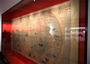
The inclusion of the Great Wall on foreign maps resulted from East-West exchanges. In the 16th century, copies of Gujin Xingsheng Zhi Tu [“Map of Advantageous Terrain Past and Present”] were introduced to Europe. This is the earliest map of China introduced to Europe that includes the Great Wall. [The copy is kept in Spain, with a digital copy on display in Xiamen, Fujian Province since July 2024.] Later, as foreign missionaries arrived in China, the Great Wall was marked in more detail on their maps. For example, Italian missionary Matteo Ricci’s Kunyu Wanguo Quantu [“Map of the Myriad Countries of the World”] features the Wall of the Ming Dynasty.
Ancient Great Wall maps reflect people’s understanding, depiction and expression of the Great Wall in their own times, which not only present military defense projects, but also carry strong cultural concepts and imprints of the times. Ancient Great Wall maps serve several purposes. They present the overall layout of the Wall and show the distribution of its various sections. These maps also depict the Wall’s positional relationships, defense facilities and architectural structure. Over time, the maps have changed, but they consistently reflect the Wall’s importance. Not only do they highlight the Wall as a physical geographic boundary, but also as a conceptual one.
CNS: The Great Wall is often compared to Hadrian’s Wall in the UK. How are they related, and how has the Wall’s significance evolved?
LX: Building cities embody humanity’s march toward civilization. And building the Great Wall represents the wisdom that arises when human society reaches certain stages in development.
More than 2,000 years ago, on both ends of the Eurasian continent, China built the Great Wall, and Europe, under the Roman Empire, built Hadrian’s Wall. The two walls share many similarities, whether it be architectural structure, defense design or function and influence on local societies and populations.
In addition to their military functions, the two walls share another thing in common: they were built on the natural, climatic and geographic boundaries between two different modes of production: farming and nomadic herding. In a deeper and broader sense, their construction prevented conflicts between societies based in these different modes of production, and had facilitated orderly trade through the exchange of goods within and outside the walls.
But the difference is, the physical function of the European wall came to a standstill after the collapse of the Roman Empire, while China’s Great Wall continued to be maintained as late as the Qing Dynasty. China’s Great Wall was not built by declining dynasties for protection, but by powerful ones to maintain unification and order. In addition, the project, carried out by successive dynasties, tightly integrated nomadic and farming economies, contributing to the formation of a unified country in East Asia. This is a prominent manifestation of state and national spirit. The Great Wall symbolizes the Chinese nation’s unity and solidarity, resilience and perseverance, peacefulness and inclusiveness.
I once climbed the Great Wall with a foreign friend, and asked him why China’s Great Wall was translated as the “Great Wall” instead of using its Chinese name, which directly translates to “Long Wall,” and what he thought about using the word “great.”
He replied that each Chinese person is like a brick in the Wall: Alone they are limited, but together, they represent a powerful spirit.

 Old Version


